Description
19th Century British Empire Map 1000 Piece Puzzle
The Antique Map Collection – The World’s Most Beautiful Jigsaw Puzzles
Antique maps are treasure troves of detail and interest at a time when much of the earth’s surface was still undiscovered. they provide us with a view into a world which was full of superstition and myth, and yet at the same time, in search of enlightenment and reason.
The world they represent is a world full of assumptions and false certainties combined with the air of superiority of the dominant European Civilisation of the time.
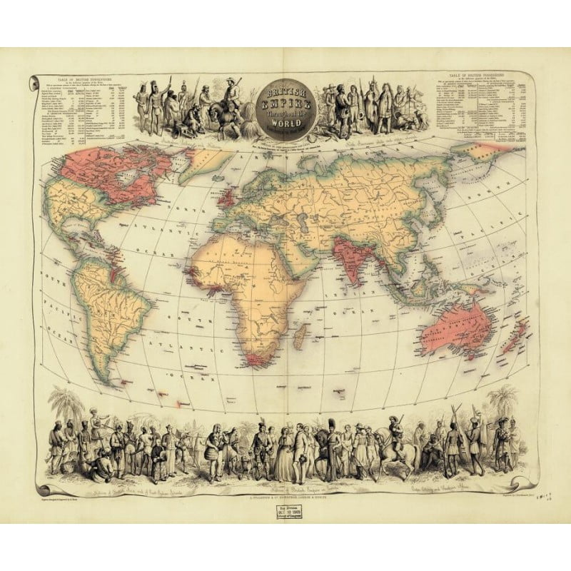
British Empire Throughout the World Exhibited in one View
This detailed map of British possessions in the Victorian 1850’s was created by the map-makers John Bartholomew and Co, who were established in Edinburgh, Scotland, by John Bartholomew, Sr. (1805-61). In the 1830’s, the firm secured the commission to produce maps for the Encyclopedia Britannica, holding this highly valued position for the next 90 years. the firm were the first to use red or pink to indicate British possessions around the world, a feature which became common to most maps for the next hundred years. In this map, which probably dates from the 1850s, a note at the top of the map states that: “The British Possessions are engraved in a bolder character and coloured Red.” The map is also framed by idealised images of friendly encounters between British colonists and indigenous inhabitants in four different parts of the globe: North America, British Asia and the Indian Islands, and the cape Colony in Southern Africa. It is highly detailed and decorative an it appeared in Fullarton’s Royal Illustrated Atlas, which was first published in 1864 after being issued in 27 parts from 1854-62. The tables shown include the size and population of the British possessions at the time of publication.


